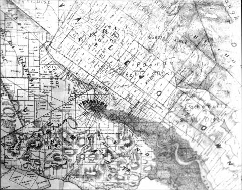
The Sonoma County Historical Map collection, located at the History and Genealogy Library, includes a variety of maps from the late 19th through 20th century, as well as aerial survey photographs. The bulk of the collection is located in the Library's Map Drawers, For full map listing, see printed guide at the library. See also:
- Sanborn Fire Insurance Maps
- Sonoma County Library Historical Map Collection (Sonoma County Local History & Culture)
- Map Resources on the Web
Map Drawers Summary Contents
Drawer 1: Sonoma County Maps
- Historical maps & modern maps of historical sites
- Promotional, road and general maps
- Political & utility district maps
- Geological, agricultural, water, etc. maps
- Miscellaneous
- USGS Maps
- US Bureau of the Census
Drawer 2: Santa Rosa
- Historic maps
- General maps post 1945
- Maps with property owner names – in chronological order
- Brochures
- Utilities
- Planning and Zoning maps
- Montgomery Village
- USGS maps
Drawer 3: Santa Rosa -- Aerial Surveys
- Santa Rosa and vicinity -- 1954 aerials
- Santa Rosa -– 1956 aerials (composite 1:6000 and 1:9600)
- Santa Rosa -- various aerials, 1963-1970s
- Santa Rosa and vicinity -- 1971 (partial set)
- Airports and environs -- 1965-1971
Drawer 4: Cotati, Rohnert Park, Penngrove and Environs
- Historical maps
- Planning maps and miscellaneous
- USGS maps
Drawer 5: Healdsburg and North County
- Ranchos, General Land Office plats and mining claim maps
- Healdsburg
- Russian River
- Other cities and miscellaneous
- USGS maps
- Aerial photographs based on USGS quads
- Sonoma County Planning Department Zoning Maps, etc.
Drawer 6: Sonoma Valley and East Sonoma County
- Historical
- Miscellaneous
- Rolled map -- Valley of the Moon Summer Resorts (1927)
- USGS Maps
- Sonoma County Planning Department Zoning Maps, etc.
Drawer 7: Sebastopol, Russian River and West Sonoma County
- Historical
- Russian River Area
- Micellaneous
- USGS Maps
- Planning Maps
Drawer 8: Roads, Bridges and Buildings
- Roads
- 19th century
- 20th century
- Bridges
- Buildings
- Parks
Drawer 9: School Districts
- Sonoma County maps
- School district maps showing locations of schools
- School district maps showing boundaries only
Drawer 10: Miscellaneous – Other California Maps, Cemetery Maps and Miscellaneous Items
- USGS Maps
- City of San Francisco historic maps
- City and County of San Francisco 1912 Election Precincts – endorsed 1920 E. D.
- Historic maps of California
- Historic maps – non-California
- Cemetery maps
- Miscellaneous
Drawer 11: Petaluma
- Map of City of Petaluma 1928, J. B. Piatt
Drawer 12: Petaluma
- Historical maps
- Sanborn fire insurance maps
- Miscellaneous maps
- Planning and zoning maps
- USGS maps
Drawer 14: Building Plans
- Brainard Jones plans
- Other architects
Drawer 15: Sonoma County General Plan
- Land use maps, 1988-1989


